Претрага
891 items
-
Investigating distant effects of the Moesian promontory: Brittle tectonics along the western boundary of the Getic unit (East Serbia)
In this study, we report evidence for brittle deformation in a part of the Carpatho–Balkan orogen, which is explained in terms of effects of the rigid Moesian promontory of the European plate on fault kinematics in East Serbia. We focus on the westernmost part of the Getic Unit of the East Serbian Carpatho–Balkanides, i.e. the Gornjak–Ravanica Unit, located between two main thrusts that were repeatedly activated from Early Cretaceous to recent times. We combine a new data set on ...Getikum, Mezijska jedinica, Karpato-balkanski orogen, krte deformacije, Gornjačko-ravanička jedinicaAna Mladenović, Milorad D. Antić, Branislav Trivić, Vladica Cvetković. "Investigating distant effects of the Moesian promontory: Brittle tectonics along the western boundary of the Getic unit (East Serbia)" in Swiss Journal of Geosciences, Springer (2019). https://doi.org/10.1007/s00015-018-0324-5
-
Contribution to the geotechnical classification of municipal waste landfills in Serbia
Management, Monitoring, Policy and Law, Nature and Landscape Conservation, Geochemistry and Petrology, Waste Management and Disposal,Geotechnical Engineering and Engineering Geology,Water Science and Technology,Environmental Chemistry,Environmental EngineeringDragoslav Rakić, Irena Basarić, Laslo Čaki, Slobodan Ćorić. "Contribution to the geotechnical classification of municipal waste landfills in Serbia" in Environmental Geotechnics, Thomas Telford Ltd. (2018). https://doi.org/10.1680/jenge.18.00028
-
Extraction of Bilingual Terminology Using Graphs, Dictionaries and GIZA++
Branislava Šandrih, Ranka Stanković (2020)U nauci, industriji i mnogim istraživačkim oblastima, terminologija se brzo razvija. Najčešće, jezik koji je „lingua franca“ za većinu ovih oblasti je engleski. Kao posledica toga, za mnoga polja termini domena su koncipirani na engleskom, a kasnije se prevode na druge jezike. U ovom radu predstavljamo pristup za automatsko izdvajanje dvojezične terminologije za englesko-srpski jezički par koji se oslanja na usaglašeni dvojezični korpus domena, ekstraktor terminologije za ciljni jezik i alat za usklađivanje delova. Ispitujemo performanse metode na domenu ...... LIS-dict including SWTs; (b) the output of the extractor Eng-TE applied to the source language part of the aligned input corpus; 3. The extraction of the set of MWTs in the target language by Serb-TE (Input iii) was done: (a) on the target language part of the aligned chunks (chunk); (b) on the target language ...
... using Eng-TE for extraction). II Number of aligned chunks after subsequent filtering using Serbian terms (Processing iii) : (S(term) ∼ S(align.chunk)) ∧ (T (term) ∼ T (align.chunk)) ∧ (S(align.chunk) ↔ T (align.chunk)). 11 To keep it simple, in the following notation, we refer to sets as to single repre- ...
... research the system was tuned to recognise 26 most frequent syntactic structures, which were previously identified by an analysis of several Serbian terminological dictionaries and the Serbian e-dictionary of MWUs (Krstev, 2008). In this paper we refer to this tool as Serb-TE. Some of these structures are ...Branislava Šandrih, Ranka Stanković. "Extraction of Bilingual Terminology Using Graphs, Dictionaries and GIZA++" in Infotheca, Faculty of Philology, University of Belgrade (2020). https://doi.org/10.18485/infotheca.2019.19.2.6
-
Clockwise vertical-axis rotation in the West Vardar zone of Serbia: Tectonic implications
The Vardar-Tethyan mega-suture between the Eurasian and Adria (Gondwana) margins comprises remnants of oceanic lithosphere of Neotethys and distal parts of the adjacent continental margins including unconformable Late Cretaceous sedimentary cover and Cenozoic igneous rocks of post-obduction age. This study provides kinematic constraints for displacements and rotations affecting the Serbian part of the West Vardar and Jadar-Kopaonik units after the closure of the Neotethyan (= Sava) Ocean. The targets of the paleomagnetic research were Late Cretaceous sediments representing an ...... o n ic in te rp re ta ti o n ar e in b o ld R em ar k s: L o ca li ty 1 : sa m p le s le ft o u t ar e m o st li k el y th e re -d ep o si te d sh al lo w w at er ca rb o n at es w it h n eg at iv e su sc ep ti b il it y ei th er sc at te re d d ir ec ti o n s o r b ad d em ag n et iz at io ...
... n u m b er o f u se d /c o ll ec te d sa m p le s; D , I (D c , I c ): d ec li n at io n , in cl in at io n b ef o re (a ft er ) ti lt co rr ec ti o n ; k an d a 9 5 : st at is ti ca l p ar am et er s (F is h er 1 9 5 3 ). T h e p al eo m ag n et ic d ir ec ti o n s, co n si d er ed in te ct o ...
... o m te ct o n ic in te rp re ta ti o n d u e to cl o se n es s to th e d ir ec ti o n o f p re se n t E ar th m ag n et ic fi el d o n th e sa m p li n g ar ea . M ag n et ic re ad in g s fo r th e fi el d o ri en ta ti o n o f th e co re s w er e co rr ec te d u si n g IG R F -1 2 In te rn at ...Vesna Lesić, Emo Márton, Violeta Gajić, Dragana Jovanović, Vesna Cvetkov. "Clockwise vertical-axis rotation in the West Vardar zone of Serbia: Tectonic implications" in Swiss Journal of Geosciences, Basel : Springer International Publishing (2018). https://doi.org/10.1007/s00015-018-0321-8
-
Geotermalne karakteristike područja Semberije , Republika Srpska
Igor Glavaš (2024)Cilj završnog rada predstavlja, opis geotermalnih karakteristika područja Semberije, Republika Srpska, BiH.Rad se sastoji od opšteg dijela u kojem se navode osnovne karakteristike područja (geomorfološke, geografske, hidrološke,hidrometeorološke, geološke, tektonske i hidrogeološke) i specijalnog dijela koji detaljnije ulazi u tematiku osobina geotermalne energije i njihovih karakteristika u zadatom području kao i definisanje geotermalnog potencijala koje to područje ima.Sa prognoznim litološkim profilima 6 dubokih istražnih bušotina su izrađena 2 regionalna geološka, a njegovom konverzijom i hidrogeološka profila na osnovu kojih je, stečena ...... pružaju od horsta Majevice sjeverno do savskog dubokog rova. Utvrđeni su ı rasjedi regionalnog karaktera i to: dubinski razlom savskog rova, sinorogeni višefazno regenerisani dinarski rasjed, te gravitacioni veliki rasjed poprečno na ovaj duž kontakta sjevernih padina Majevice i nizije. U geotektonskom ...
... potrebe stambene zgrade u Jermenskoj ulici u gradu Bijeljina gdje su konstruktivni elementi u oba ista, s tim da je Jedan upojni, a drugi eksploatacioni: 41 Prognozni litološki profil B-I 10 mi Datum izrade: novembar 2020. god. x: 4957 462 Temperatura podzemnih voda: 15 'C y:6 596 155 z: ...
... m Slika 4.9. Prognozni litološki profil bunara B-1 (preuzeto iz Elaborata o hidrogeološkim istraživanjima za potrebe grijanja stambenog objekta „.LD” u ulici Jermenska u Bijeljini) Prognozni profil Nortonovih bunara Je objašnjen kroz NB-1, s tim da se radi o istoj litologiji i konstruktivnim ...Igor Glavaš. Geotermalne karakteristike područja Semberije , Republika Srpska, 2024
-
Karst aquifer impact on the formation of surface runoff: case study of the Resava River catchment, Serbia
Marina Mitrašinović, Vesna Ristić Vakanjac, Veljko Marinović, Saša Milanović, Ljiljana Vasić, Dušan Polomčić (2022)The paper compares the flow regimes of the Resava River at the gauging stations of the Manasija Monastery (upper course) and the town of Svilajnac (lower course). The hydrological analysis encompasses a multiyear period of monitoring (1982–2020). The water budget and baseflow index are assessed for the catchment areas monitored by the Svilajnac station (683 km2) and the Manasija Monastery station (358k m2), considering the overall monitoring period and characteristic years. The results indicate that the specific runoff in ...... SBSBSSBS BBB R B B G B BBB a dii 0 š . a bvu.ž·ižšjžrgozn |—g.s. at Manasija Monastery —-g:5. at Svilajnac |—C-g5. at Manasija Monastery —-g.5. at Svilajnac • 180 . 160 s s o : z a : o g 10 P Ž ž Š w š š k i 33 Š o |}] E 40 || > o LJ 2808 888 8#8.8#8.4. 8 + žž BII II I I ŠGU 39 8B B ! Š Š 9 ž ...
... ž Š Š Š 3 'B B ! Š BI B R BO Cju.=<21”·(3320 d BB BSKSSBIBISB IBE —. at Manssin Mopasisty ——g:s. atvisjne ——>s at Manasija Monastery —-g.s. at Svilajnac Fig. 1. Catchment of the Resava River and parallel discharge hydrographs of characteristic years: (q) and (b) years in which the mean annual discharge ...
... 4. In addition to these aquifer types, therc arc “conditionally waterless” parts of thc terrain, with rocks, which hydrogeological properties arc not conducive to the formation of aquifers. Flow regime of the Resava River The following characteristic years were selected to show the flow regime ...Marina Mitrašinović, Vesna Ristić Vakanjac, Veljko Marinović, Saša Milanović, Ljiljana Vasić, Dušan Polomčić. "Karst aquifer impact on the formation of surface runoff: case study of the Resava River catchment, Serbia" in National Conference with International Participation “GEOSCIENCES 2022”, Sofia : Bulgarian geological society (2022)
-
Препреке декарбонизацији система даљинског грејања у Србији - ставови представника топлана
Производња топлоте у системима даљинског грејања у Републици Србији тренутно се заснива искључиво на процесима сагоревања, с доминантним уделом природног гаса из увоза. Иако су технологије за коришћење обновљивих и алтернативних извора енергије добро познате, њихова примена у системима даљинског грејања у Републици Србији још увек је занемарљива (око 2%). Како би се убрзао и олакшао процес транзиције ка обновљивим изворима енергије и разумело тренутно стање и перспектива, спроведена је анкета међу представницима топлана Србији. Циљ је био ...Марија Живковић, Дејан Ивезић, Бобан Павловић, Дејан Стојановић. "Препреке декарбонизацији система даљинског грејања у Србији - ставови представника топлана" in Стручно-научна конференција ТОПС 2024, Златибор, Јун 2024, Пословно удружење "Топлане Србије" (2024)
-
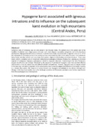
Hypogene karst associated with igneous intrusions and its influence on the subsequent karst evolution in high mountains (Central Andes, Peru)
Carbonate rocks of Cretaceous age are wide spread in the Peruvian Andes. The studied area in the eastern part of the Cordillera Occidental, near a large igneous intrusion and a skarn deposit, exemplifies polygenetic and multi-phase karst development. Hypogene karstification is related to a hydrothermal activity associated with a magmatic event at ca. 11-9.7 Ma responsible for the emplacement of the nearby intrusion and related alteration of the carbonate rocks. It has resulted in deep-rooted, laterally isolated stair-case-rising shaft ...Alexander B. Klimchouk, Saša Milanović, Cristian Bittencourt. "Hypogene karst associated with igneous intrusions and its influence on the subsequent karst evolution in high mountains (Central Andes, Peru)" in Conference: 21st International Congress of Speleology, France, June 2021, France : ICS (2021)
-
Nelinearno dinamičko modelovanje potresa izazvanih promenom naponskog stanja pri izradi horizontalnih podzemnih prostorija
Srđan D. Kostić (2013-11-04)U ovoj disertaciji, cilj istraživanja bio je određivanje dinamičkih svojstava potresaizazvanih promenom naponskog stanja pri izradi horizontalnih podzemnih prostorija.Analiza potresa izvedena je sa dva aspekta – u prvom delu istraživanja izučavane suvremenske serije oscilovanja tla za vreme potresa, a u drugom delu vršena je analizastabilnosti fenomenološkog Baridž-Knopof modela bloka sa oprugom. Vremenske serijeoscilovanja tla proučavane su primenom postupka analize surogat podataka, kao ikorišćenjem metoda analize nelinearnih vremenskih serija (primena teoreme orazvijanju skalarne vremenske serije). Analiza vremenskih serija izvedena je ...potres, naponsko stanje, podzemne prostorije, bifurkacije, vremenskaserija, deterministički haos, stohastičnost, perturbacije, vremensko kašnjenje, jačina trenja... potencijalne energije u posmatranom sistemu, i poređenja te distribucije sa Gutenberg-Rihter3 i Omori-Utsu zakonom4 koji važe za tektonske zemljotrese. U tom smislu, razmatrana su dva slučaja: a) kada su blokovi povezani oprugama istih karakteristika; b) kada su blokovi povezani oprugama različitih k ...
... se jedan vektor na sledeći način: svaki prolaz i-te trajektorije kroz k-to polje generiše jedinični vektor ei, čiji je pravac i smer određen pravcem i smerom trajektorije sistema unutar posmatranog polja. Konačna aproksimacija vektora Vk u k-tom polju faznog prostora predstavlja, u suštini, srednju ...
... Proper choice of time delay for the analysis of chaotic time series, Physical Letters A 142, 107-111. 102.Lise, S. Paczuski, M. 2001. Self-organized criticality and universality in a nonconservative earthquake model, Physical Review E 63, 036111-1-5. 103.Lorig, L., and Hobbs, B. 1990. Numerical ...Srđan D. Kostić. "Nelinearno dinamičko modelovanje potresa izazvanih promenom naponskog stanja pri izradi horizontalnih podzemnih prostorija" in Универзитет у Београду, Универзитет у Београду, Рударско-геолошки факултет (2013-11-04)
-
Fuzzy stohastički model izbora sistema otvaranja podzemnog rudnika
Saša M. Jovanović (2016-05-16)Investiciono okruženje skopčano sa rudarskom industrijom je veoma svojstveno kada seuporedi sa okruženjima koje susrećemo u tipičnim proizvodnim industrijama. Neke odkarakterisitka rudarstva, koje su često naznačene kao jedinstvene su: visok intenzitetinvesticija, dugi predproizvodni periodi, visok rizik i neobnovljivost resursa.Investiranje u sistem otvaranja rudnika predstavlja dobar primer ireverzibilneinvesticije. Takva investicija zahteva pažljivu analizu, jer nakon njene realizacije ona sene može nadoknaditi bez značajnog gubitka vrednosti. Očigledno je da izbor sistemaotvaranja podzemnog rudnika pripada strateškom planiranju...... 1 7 .44 B K -3 /9 0 7 8 1 .97 B K -1 3 /90 7 10 .39 B -10 /90 7 09 .3 B K -4 /9 0 7 32 .53 B -1 /8 9 701 .4 B K -8 /90 7 20 B K -9 /9 0 B K -5 /9 0 B 6 5 B 15 5 B 15 9 B 1 52 7 6 5 .34 B K -2 /9 0 7 28 B K -1 4 /9 0 vb b b 2 2 to lo w e r le ve l lo ad in g po in t to su rfa ...
... slici br. 23 b. 58 a) b) Slika br. 23 Transformacija verovatnoće (a) u mogućnost (b) Zatim se neodređenost ulaznih podataka može dalje modelirati primenom trouglastih fuzzy brojeva. Razmotrimo jedan ulazni parametar okarakterisan skupom merenih veličina, pri čemu se te veličine raspodeljuju ...
... mogućnosti. U tom kontekstu, funkcija pripadnosti skupu μ se uzima kao funkcija mogućnosti π [1]. Pretpostavimo da imamo unimodalnu funkciju gustine verovatnoće (fgv) p unutar ograničenog intervala [a,c], tako da je p rastuća u intervalu [a,b], a opadajuća u intervalu [b,c], gde je b modalna vrednost ...Saša M. Jovanović. "Fuzzy stohastički model izbora sistema otvaranja podzemnog rudnika" in Универзитет у Београду, Универзитет у Београду, Рударско-геолошки факултет (2016-05-16)
-
Two approaches to compilation of bilingual multi-word terminology lists from lexical resources
In this paper, we present two approaches and the implemented system for bilingual terminology extraction that rely on an aligned bilingual domain corpus, a terminology extractor for a target language, and a tool for chunk alignment. The two approaches differ in the way terminology for the source language is obtained: the first relies on an existing domain terminology lexicon, while the second one uses a term extraction tool. For both approaches, four experiments were performed with two parameters being ...Branislava Šandrih, Cvetana Krstev, Ranka Stanković. "Two approaches to compilation of bilingual multi-word terminology lists from lexical resources" in Natural Language Engineering, Cambridge University Press (CUP) (2020). https://doi.org/10.1017/S1351324919000615
-
Услови заштите изворишта подземних вода “Јарош“ за водоснабдевање Сомбора
Ивана Јовановић (2024)Територија града Сомбор се налази у периферном северозападном делу Војводине, односно Србије, у близини границе са Хрватском. Сам град Сомбор се налази југозападном делу територије и представља гравитациони центар тог подручја. Повољан географски положај условио је афирмацију Сомбора као градског насеља, са јаком пољопривредом, индустријом, занатством и прометом. "ВОДОКАНАЛ" из Сомбора је јавно комунално предузеће чија је основна делатност захват сирове подземне воде, њен третман, и дистрибуција ка потрошачима Сомбора и приградских насеља и насељених места: Лугова, Жарковца, Чонопље, ...... pyesaai z ga BG O AR IN HOL OOR LO RNA y I BLR OOO 33 NH TPO,THHAMHUKA AHA.TIH3A PEŽKHMA TIO,13EMHHX BO,TA HA H3BOPHITITY „JAPOIJI“ Y COMIBOPYy i ı OO OO 40 7.2. HS3PAJIA XHJIPO/IMHHAMHHGdKOT MO/TE-/TA IHHPET IIOJTPVUJA H3BOPHIIHTA _JAPOLTI“ SA BOJJOCHAB,TEBAĐE TEPHTOPHJE TPAJIA COMBOB L al pyasaiL ...
... 3AIHTHTE IIO,T3EMHHX BO,TA H3BOPHIIITA „JAPOTIT“ 3A BOJIOCHAB/TEBAFbE COMEBOPA ... O a a e caJerakoen--OMŠ 9. H3BOPH IIOTEHTIHJA.THHX 3AT AĐEĐĐA H OIIEHA CTAĐA HOCTOJE TE POLITEKICA a a as a aA a a V OE OO O A 58 10. IIPE,T.TOT MEPA 3A YCIIOCTAB.bAĐĐE KOHTHHYA.IHOF MOHHTOPHHT A BO,TA Y 3OHAMA CAHHTAPHE ...
... IIpHiHKoM H3pa;te KapTre aHantH3HpaHH cy cnenehH (bakTopH: Oakrop S Cnoco0HocT 3eM:bHmITa a 3a1p;KaBa BOJIy ripe;icTaB-ba JenaH 0J1 paKTopa KOJH yrıHue Ha BehnHHHHy HH(pHnrpatije BOJe y non3eM-be. JezaH OJ TepMHHa KOJH Ce KOpHCTH 323 neQnHHHcabbe CIIOCOOHOCTH 3eM:bHmITa JTa 3a;1p;kaBa BOJIy je TO-BCKH ...Ивана Јовановић. Услови заштите изворишта подземних вода “Јарош“ за водоснабдевање Сомбора, 2024
-
Application of machine learning for diagnosing the operation of a deep well pump in oil production
Maja Trikić (2024)This paper will thoroughly examine how machine learning can improve the diagnosis of deep well pumps by analyzing the role and function of the pumps, dynamograms, sensor technologies, and diagnostic methods.Our analysis will provide insights into modern techniques and approaches for enhancing the performance and reliability of oil production systems, targeting cost reduction and increased operational efficiency.deep well pump, dynamograms, machine learning, diagnostics of operating coditions,Random Forest, XGBoost... 12 b o ' Li L “ [] LJ ? LI vromoe (%5e0C}) Figure 3.1 time functions of load and stroke of the smooth rod Š·o i E PR N a a m e .'! ” L A_'A––––Ev @llšsss·zlll B dı | | | oO e % 2 «0 bl · tod glatko Sipko S(cm) Figure 3.2 Dynamograms of downhole pump operation: a})load, b)surface ...
... perform on unseen data, helping to evaluate the model's stability and robustness. • Model Application a.Prediction - The model is used to predict the pump's condition in real-time based on current sensor data. This allows for timely identification of potential issues. b. Fault Classification - Based ...
... y (b = 0, 1, 2, 3, ...).When using wavelet descriptors in machine learning (ML,, it is essential to select the type of transform (CWT or DWT), the wavelet function, and the level of scale. This flexibility is an advantage of wavelet functions, but it is crucial to test different options to find ...Maja Trikić. Application of machine learning for diagnosing the operation of a deep well pump in oil production, 2024
-
Trace elements and garnet formation in a distal skarn zone: a case study of the Rudnik deposit, Central Serbia
Bojan Kostić, Pavle Tančić, Natalija Batoćanin. "Trace elements and garnet formation in a distal skarn zone: a case study of the Rudnik deposit, Central Serbia" in Geological Quarterly, septembar 2024, Polish Geological Institute - National Research Institute (PGI-NRI) (2024). https://doi.org/10.7306/gq.1752
-
Fault type assessment based on vertical gravity gradient anomalies – advantages and limitations
The type of dip-slip faults can be assessed based on the analysis of vertical gravity gradients. Theoretically, just a simple comparation of the gradient extreme values can give us an answer whether the fault is normal or reverse (thrust). Practical application of this method is far more complicated and the results depend on a number of parameters, such as a complexity of geological setting, the quality of gravity data, dip angle and displacement of the fault, density contrast, etc. ...... gravity gradient (Uzz) curves over (a) normal fault and (b) reverse fault with negative density contrast (Ao) — uncommon density distribution According , to the ” theoretical (synthetic) models shown on Fig. 1 and Fig. 2, it is easy to determine the type of the dip-slip fault and approximate ...
... ELS – THE KEY TO DIAGNOSTICS OF SEDIMENTATION ENVIRONMENTS ON THE EXAMPLE OF PONTIAN SEDIMENTS OF THE PANNONIAN BASIN (SERBIA) Flena Zhukovskaya, Nadezhda Gatina,Anatoliy Saprygin, Svetlana Redina, Milica Yankovic BIOSTRATIGRAPHIC CHARACTERISTICS OF SEDIMENTS IN BOREHOLE B-70 AT THE TETIMA ...
... curves over (a) normal fault and (b) reverse fault with positive density contrast (Ao) — common density distribution The vertical gravity gradient curve above the inclined fault is asymmetric in shape. The shape of the curve around the extreme value closer to the fault line (dashed lines on ...Ivana Vasiljević, Snežana Ignjatović, Branislav Sretković. "Fault type assessment based on vertical gravity gradient anomalies – advantages and limitations" in Vth Congress of the Geologists of the Republic of North Macedonia, Ohrid, Republic of North Macedonia, September 27-28, 2024, Macedonian Geological Society (2024)
-
Numerical modeling of Selanac debris flow propagation using SPH code
The Selanac debris flow is a very huge event triggered after extreme rainfall caused by Cyclone Tamara activity in the Republic of Serbia in May 2014. The Selanac case study was already modelling in different programs using Voellmy rheology assumptions like RAMMS software. In this paper research are focusing particularly on the process of debris flowing from initiation zone to main deposition area using Geoflow SPH two-phase model considering frictional rheology law. Main rheological parameters are back-calculated using also ...... heights A) 16s B) 30s C) 50s D) 100s SCG-XIII INTERNATIONAL SYMPOSIUM ON LANDSLIDES. CARTAGENA, COLOMBIA- JUNE 15th-19th-2020 Figure 4 Erosion depths in meters in time steps A) 16 s B) 30 s C) 50 s D)100 s 5 CONCLUSIONS Final models show accurate results comparing to the depths in ...
... al. (2009) considering: A. balance of mass of the mixture—propagating along the slope and increasing due to bed entrainment—combined to the balance of linear momentum of pore water, B. the balance of linear momentum of the mixture, C. a kinetic relation between the deformation-rate tensor ...
... May 2014. Figure 2 A) Location of case study B) geometry and main parts 3 METHOD SPH (Smoothed Particle Hydrodynamics) was firstly proposed by Lucy (1977) and Gingold and Monaghan (1977) and applied in astrophysical modeling. In time, it became widely used in different fields (Liu and ...Jelka Krušić, Biljana Abolmasov, Miloš Marjanović, Manuel Pastor, Saeid M. Tayyebi . "Numerical modeling of Selanac debris flow propagation using SPH code" in SCG-XIII International Symposium on Landslides. Cartagena, Colombia- February 22-26, 2021, International Society for Soil Mechanics And Geotechnical Engineering (2021)
-
Analysis and visualization of geophysical well-logging data from closely spaced boreholes
Geophysical logging measurements for determining the condition of the rock mass on the dam profile and locating the predisposed directions of water circulation and loss from the reservoir were conducted in four boreholes distributed at a close distance. The survey was carried out in a typical karst terrain, which is an additional challenge for defining the geological model, especially in terms of water retention. That kind of data set provides an excellent opportunity for a new approach to analysis ...... correlation coefficient R) shows ruptures and karstified zones. Be va to n( m) Detance (m) Figure 1. Integration of 1D log data Kom boreholes into 2D view. Examples: (a) gamma ray and (b) spontaneous-potential logs. Sn-Gamma (b) R a 4 Sp-Gamma (a) Pwat3 Ele vat ion ( m). Ele vat ion ...
... ELS – THE KEY TO DIAGNOSTICS OF SEDIMENTATION ENVIRONMENTS ON THE EXAMPLE OF PONTIAN SEDIMENTS OF THE PANNONIAN BASIN (SERBIA) Flena Zhukovskaya, Nadezhda Gatina,Anatoliy Saprygin, Svetlana Redina, Milica Yankovic BIOSTRATIGRAPHIC CHARACTERISTICS OF SEDIMENTS IN BOREHOLE B-70 AT THE TETIMA ...
... of pairs of data sets. Examples: (a) Self potential/ gamma ray (b) Short-normal resistivity/y/yamma ray and (c) Long-normal resistivity/gamma ray. CONCLUSION The procedures shown in this paper, represent a different approach to the well- logging data processing. It can be successfully done using ...Branislav Sretković, Ivana Vasiljević, Dimitry Sidorov - Biryukov. "Analysis and visualization of geophysical well-logging data from closely spaced boreholes" in Vth Congress of the Geologists of the Republic of North Macedonia, Ohrid, Republic of North Macedonia, September 27-28, 2024, Macedonian Geological Society (2024)
-
Fluid inclusion systematics in the Okoška gora polymetallic deposit
... & Marko, L. 2 to Early Cambrian crustal growth and orogenic zonih, Авсап Стаоп—Сопзтани from U-Pb zircon ages ani Germany). - Precambrian Research, 224, 236–278. Mioč, P. 1972: Basic Geological Map of Yugoslavia 1:100.000.5 to the Sheet Slovenj Gradec. Federal Geological Survey B Sigesmund,S., ...
... SI (b). Primaryfluid inclusion assemblage in quariz (c) and secondary assemblage т диатг (а). 125 Geološki zbornik 26 Acknowledgements The authors would like to acknowlegde prof. dr. Vladica Cvetković for providing acc: to the ...
... 1:100.000. Sheet Slovenj Gradec. Interpreli to the Sheet Slovenj Gradec. Federal Geological Survey Belgrade, 74 pp. Schmid, S. M., Fiigenschuh, B., Kounov, A., Matenco,L., Nievergelt, P.. Oberhinsli, R., Picuge Schefer, S., Schuster, R., Tomljenovič, B., Ustaszewski, K.. & van Hinsbergen, U. 3. J ...Aleš Šoster, Miloš Velojić, Barbara Potočnik Krajnc, Matej Dolenec. "Fluid inclusion systematics in the Okoška gora polymetallic deposit" in 25th meeting of Slovenian geologists, Ljubljana, 2021, Univerza v Ljubljani, Oddelek za geologijo (2021)
-
An arid phase in the Internal Dinarides during the early to middle Miocene: Inferences from Mg-clays in the Pranjani Basin (Serbia)
N. Andrić-Tomašević, V. Simić, O. Mandic, D. Životić, M. Suárez, E. García-Romero. "An arid phase in the Internal Dinarides during the early to middle Miocene: Inferences from Mg-clays in the Pranjani Basin (Serbia)" in Palaeogeography, Palaeoclimatology, Palaeoecology, Elsevier BV (2020). https://doi.org/10.1016/j.palaeo.2020.110145
-
Multihazard Exposure Assessment on the Valjevo City Road Network
Miloš Marjanović, Biljana Abolmasov, Svetozar Milenković, Uroš Đurić, Jelka Krušić, Mileva Samardžić Petrović (2019)Miloš Marjanović, Biljana Abolmasov, Svetozar Milenković, Uroš Đurić, Jelka Krušić, Mileva Samardžić Petrović. "Multihazard Exposure Assessment on the Valjevo City Road Network" in Spatial Modeling in GIS and R for Earth and Environmental Sciences, Elsevier Inc (2019). https://doi.org/10.1016/B978-0-12-815226-3.00031-4.

